Home - Castile and León crop and natural surfaces
Home
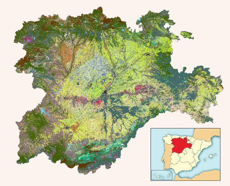
Castile and Leon crops and natural land map (MCSNCyL, Spanish acronym) is a land cover layer, updated annually, obtained through satellite imagery. The goal of the project is to produce a land use map that represents the changes in annual arable crops as well as permanent crops and the areas of natural vegetation. The project began in 2013, and since then layers have been generated from 2011 to the present using machine learning. In addition, since 2020 two differentiated layers have been published, one showing the type of crop or surface detected and the other with the exploitation system (rainfed / irrigated) identified by remote sensing.
The procedure implies the use of images from Deimos-1 (2011-2016), Landsat 8 (2013-2016), Sentinel-2 (2016-present) satellites.
From 2017 onwards the spatial resolution is improved from 20 to 10 m as long as Sentinel-2 imagery becomes more reliable in terms of availability. The classification is performed using a machine learning algorithm trained with data retrieved from several sources, especially Integrated Administration and Control System for Common Agricultural Policy subsidies database and some other Land use databases available in Spain (Land Parcel Identification System, SIOSE, Mapa Forestal, etc.). This approach does not require any fieldwork.
The project is led by the Agricultural Technical Institute of Castilla y León (ITACyL), with the collaboration of the Castile and León Regional Ministry of Public Works and Environment and the Regional Ministry of Agricultural, Livestock, and Rural Development cooperate in the supply of training cases. The project is an adaptation of the US Crop Data Layer from the US Department of Agriculture.
This work has allowed us to be part of the consortium of different research projects of the Horizon 2020 program of the European Commission. Among others, Sentinels Synergy for Agriculture (SENSAGRI) aimed to exploit the capabilities of the optical (S-2) and radar (S-1) sensors of the satellites of the Sentinel constellation for the development of prototypes for monitoring agricultural activity. Likewise, it is worth noting the relevance that this map of great thematic detail is having in the process of Checks by Monitoring (CbM) in the management and control of the Common Agricultural Policy (CAP) subsides in Castilla y León.
The overall classification accuracy in 2021 was 94% on average (kappa coefficient around 0.94), being generally higher in permanent crop classes than in other crops or natural land. The overall accuracy has already reached 95% in the recently published provisional map of 2022. The accuracy obtained in the provisional version of Binary Map of Irrigation effective in Castilla y León for the year 2022 has been over 96% identifying the areas actually irrigated detected by remote sensing.
Further information about the project and the class-specific accuracy metrics obtained from this land cover map can be found in the following published scientific papers:
- "Mapa de cultivos y superficies naturales de Castilla y León" published in the XVI Congress of the Spanish Association of Remote Sensing in 2015 (in Spanish language).
- Poster presented in the 2017 ESA World Cover Conference.
- "Accuracy assessment of a 122 classes land cover map based on Sentinel-2, Landsat 8 and Deimos-1 images and ancillary data" published in the 38º International Geosciences And Remote Sensing Symposium in 2018 (IGARSS 2018) and the poster presented there.
- "Seguimiento y evaluación de la capacidad de discriminación de cultivos herbáceos en regadío a partir de imágenes de satélite en el periodo 2016-2018" published in the XVIII Congress of the Spanish Association of Remote Sensing in 2019 (in Spanish language).
- "A Methodological Approach for Irrigation Detection in the Frame of Common Agricultural Policy Checks by Monitoring" Agronomy. 2020; 10(6):867 https://www.mdpi.com/2073-4395/10/6/867
More information about the project can be found in this presentation in English.
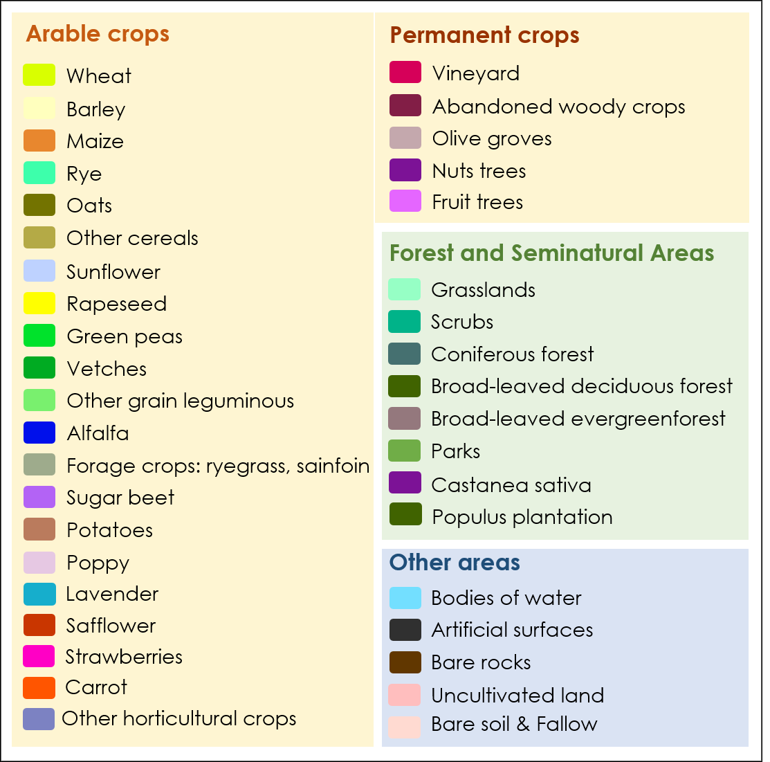
Map Legend