Downloads

Downloads

This section offers the user the possibility of downloading the information provided by the web. Two types of access are allowed, either through the OGC (Geospatial Consortium) services, access to cartographic information in a standard and interoperable way through the Internet, or through the download of files.

OGC Services

OGC Services

In this section information for data access is provided. You can connect a Geographical Information System (GIS) such as QGIS or a web viewer to the Crop and natural land map layers using WMS or WCS standards using the following URL:

WMS: http://mcsncyl.itacyl.es/arcgis/services/MCSNCyL/MapServer/WMSServer?request=GetCapabilities&service=WMS

WCS: http://mcsncyl.itacyl.es/arcgis/services/MCSNCyL/MapServer/WCSServer?request=GetCapabilities&service=WCS

Download raw raster data and maps

Download raw raster data and maps

Alternatively, data layers could be downloaded for the different years. Layers are presented in ZIP files that contains a RAW raster format (TIF) and a PNG map composition. To visualize raster data a GIS should be used. The content of each ZIP is broken down into the following components:

  • Raster of the Castile and León crop and natural surfaces layer corresponding year "TIF" format.
  • "QML" style file for QGIS to load it with the appropriate symbology.
  • "LYR" style file for ArcMap to load it with the appropriate symbology.
  • "CSV" file with coding classes and colour assigned in RGB for use in other GIS tools.
  • Folder "DatosBrutos" or Raw data, contains the raster file in TIF format indicated in the first point, but without incorporating artificial land, mainly roads, from LPIS.
  • Article published in the International Geoscience and Remote Sensing Symposium IGARSS2018, describing the product and assessing the accuracy metrics. 
  • Metadata file.


NOTICE: We recommend using Google Chrome or Mozilla Firefox (latest versions) to download the files. Using another browser might cause problems.

Asset Publisher

  1. 2022 - Castile and León crops and natural land map in 2022 Duplicate 1
  2. 2022 - Castile and León crops and natural land map in 2022
  3. 2022 - Actually irrigated areas map of Castile and León in 2022
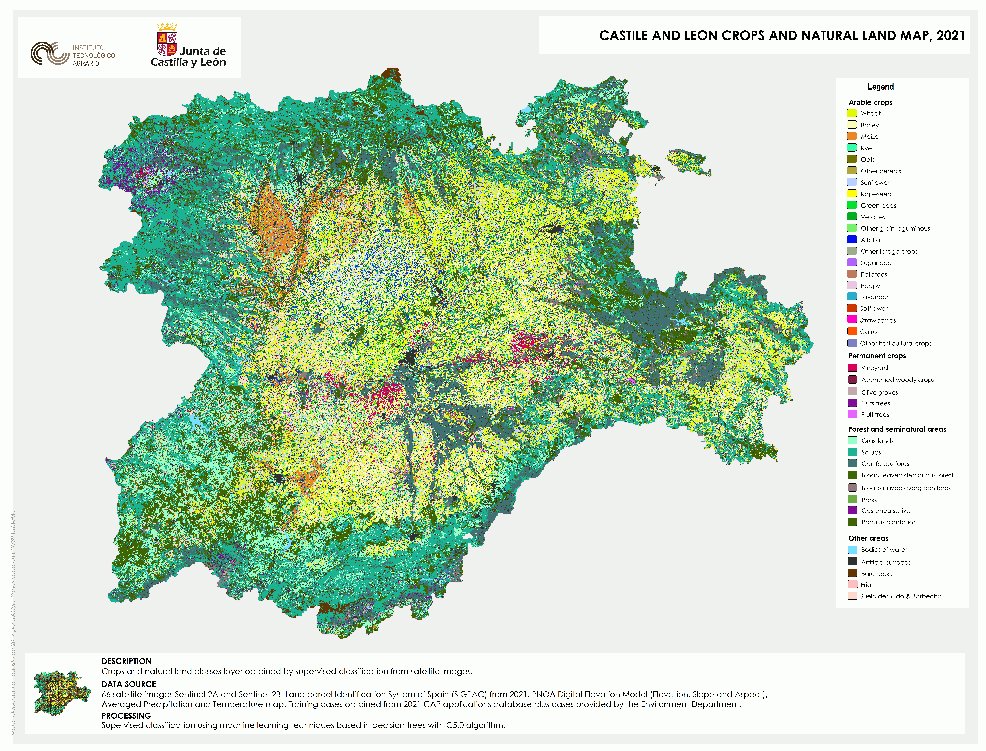
  4. 2021 - Castile and León crops and natural land map in 2021
  5. 2021 - Actually irrigated areas map of Castile and León in 2021
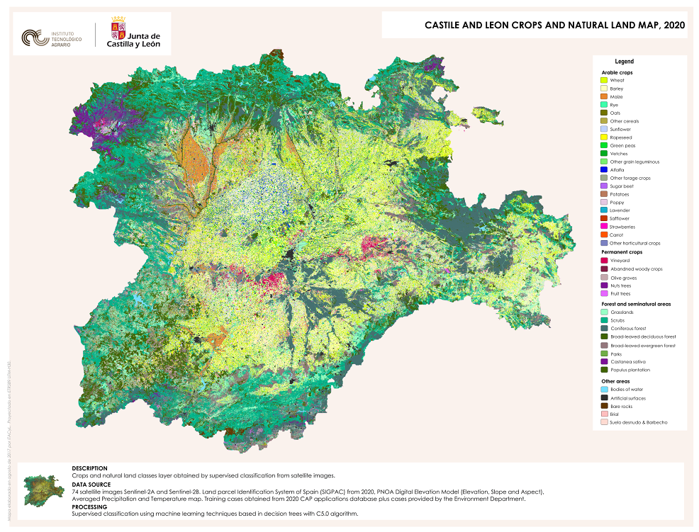
  6. 2020 - Castile and León crops and natural land map in 2020
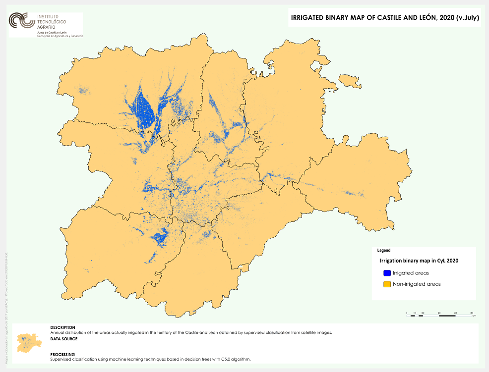
  7. 2020 - Actually irrigated areas map of Castile and León in 2020
  8. 2019 - Castile and León crops and natural land map in 2019
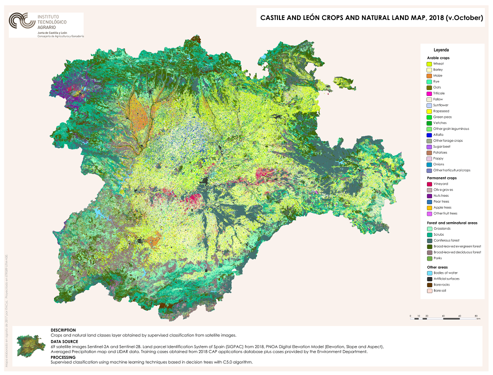
  9. 2018 - Castile and León crops and natural land map in 2018
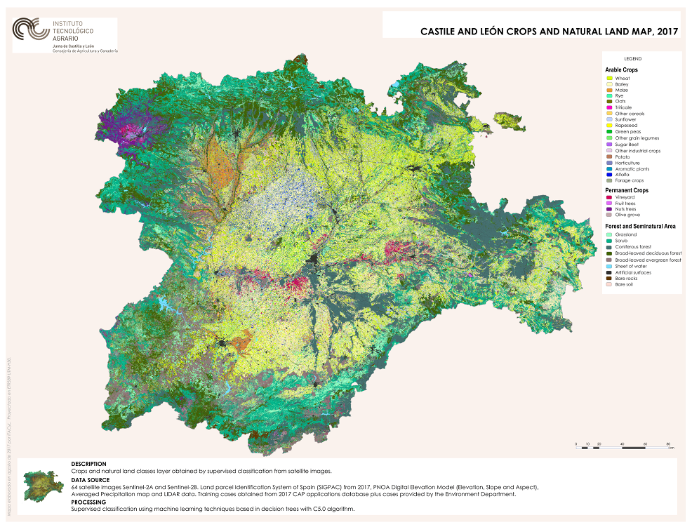
  10. 2017 - Castile and León crops and natural land map in 2017
  11. 2016 - Castile and León crops and natural land map in 2016
  12. 2015 - Castile and León crops and natural land map in2015
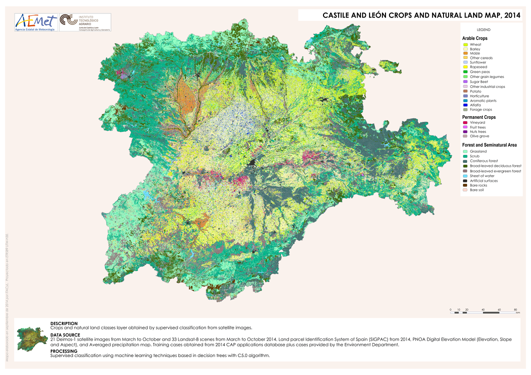
  13. 2014 - Castile and León crops and natural land map in 2014
  14. 2013 - Castile and León crops and natural land map in 2013
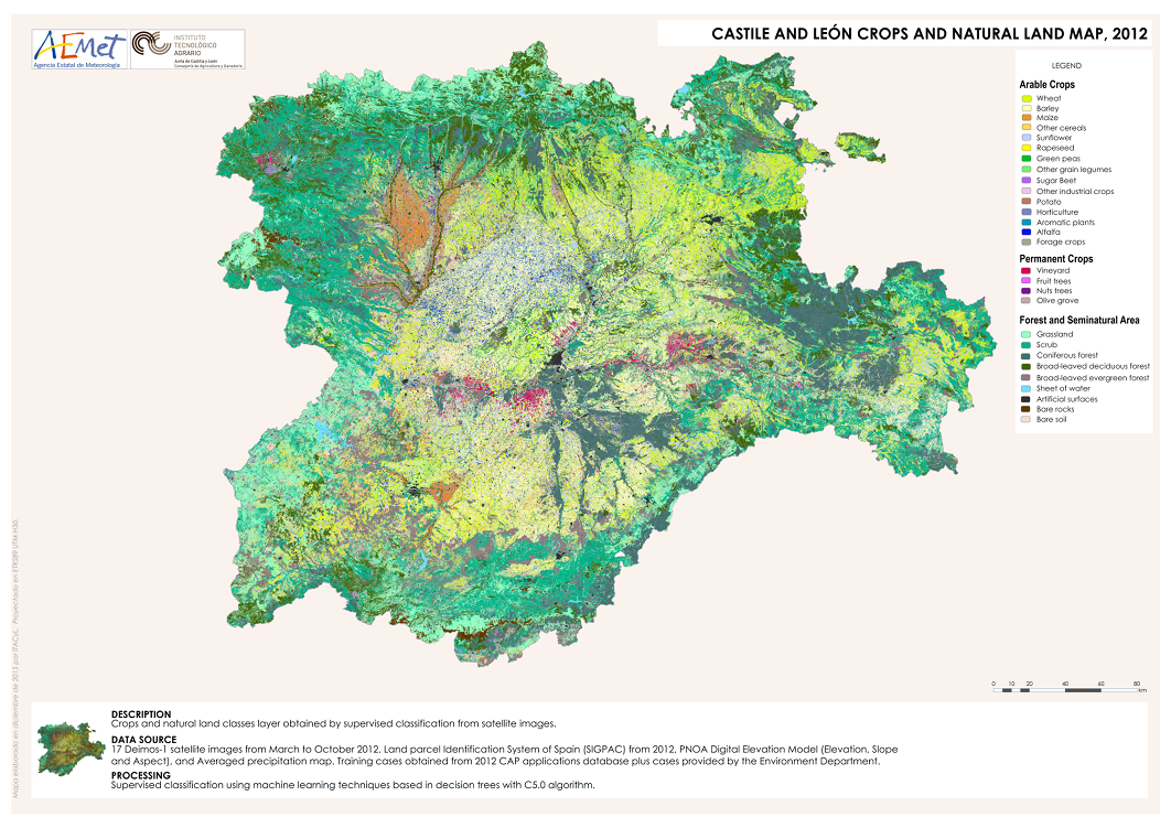
  15. 2012 - Castile and León crops and natural land map in 2012
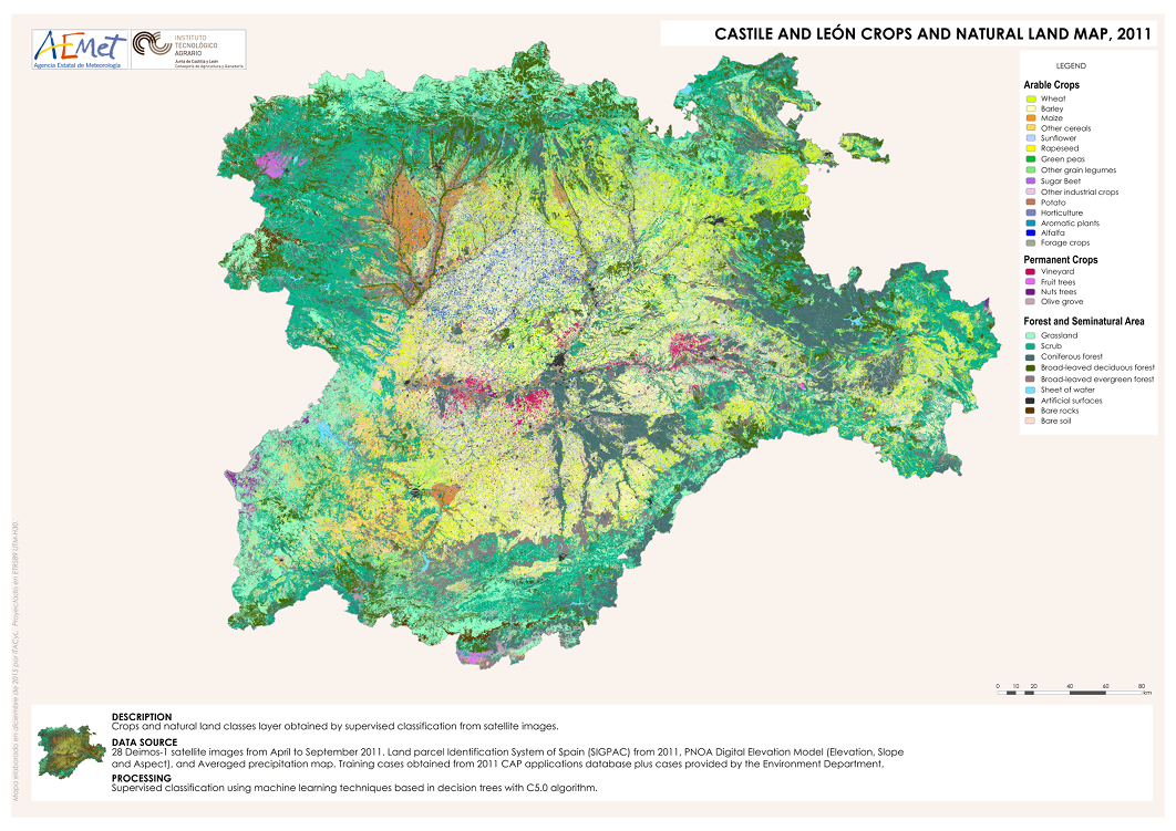
  16. 2011 - Castile and León crops and natural land map in 2011